
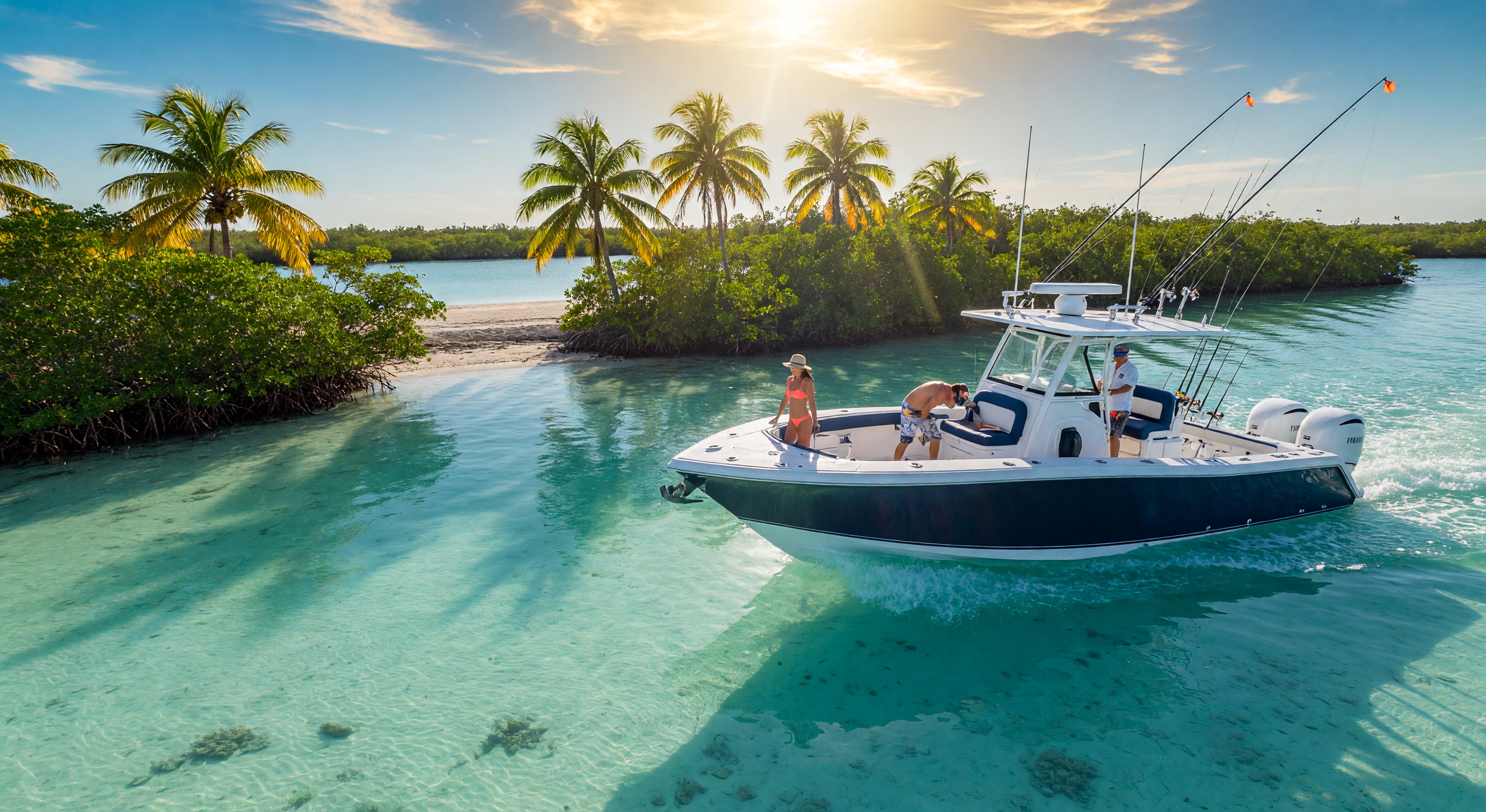
Florida Keys Map: Your Complete Guide to the Island Chain
Stretching from Key Largo to Key West, the Florida Keys are connected by the Overseas Highway and linked by over a century of history. Explore each community below to find the island that fits your lifestyle.
This Florida Keys map is an interactive guide to the 112-mile island chain, showing every major community from Key Largo to Key West with mile markers, neighborhoods, and points of interest. Whether you need a detailed map of the Florida Keys for trip planning or are searching for the perfect island to call home, this guide covers it all.
Tap any area label to explore that community's listings and lifestyle.
Major Communities of the Florida Keys
Each community has its own mile marker range, personality, and lifestyle. Here is how the island chain breaks down from north to south.
Key Largo
MM 106-90The northern gateway to the Keys, home to John Pennekamp Coral Reef State Park and canal-front neighborhoods with direct ocean access.
Tavernier
MM 91-87A quiet residential community between Key Largo and Islamorada, offering dual waterfront access and the home of the Conley Sales Group at COMPASS.
Islamorada
MM 86-73The Sportfishing Capital of the World, a village of six islands known for world-class fishing, art galleries, and spectacular bayfront sunsets.
Marathon
MM 54-47The commercial and residential center of the Middle Keys at the foot of the Seven Mile Bridge, with a working-waterfront character.
Big Pine Key
MM 33-30Home to the National Key Deer Refuge, offering large lots, mature trees, and a genuine Old Florida Keys atmosphere for nature lovers.
Lower Keys
MM 29-0The southernmost stretch including Key West, Sugarloaf Key, and the islands leading to the vibrant, walkable crown jewel of the Keys.
Every Island Has a Personality
Click into any community to see available listings and learn what makes it unique.
The northernmost and largest island in the Keys, Key Largo is just an hour from Miami yet feels a world away. Home to John Pennekamp Coral Reef State Park, the first undersea park in the U.S., it is the diving and snorkeling capital of the world. Bayside neighborhoods like Port Largo and Plantation Key offer canal-front homes with easy ocean access.
- Diving & snorkeling capital
- John Pennekamp State Park
- Canal-front neighborhoods
- Closest to mainland
A quiet, residential community nestled between Key Largo and Islamorada. Tavernier offers a relaxed pace with easy access to both the Atlantic and Florida Bay. Local marinas, the Tavernier Creek Marina, and charming waterfront dining define the lifestyle. Home to the Conley Sales Group at COMPASS.
- Residential & peaceful
- Dual waterfront access
- COMPASS office location
- Local marinas & dining
A village of six islands stretching across twenty miles, Islamorada is where world-class sportfishing meets upscale island living. Gallery row, waterfront fine dining, and spectacular Florida Bay sunsets make this a magnet for discerning buyers. The median home price reflects its premium status in the Keys.
- World-class sportfishing
- Art galleries & fine dining
- Bayfront sunset views
- Village of islands
The commercial and residential center of the Middle Keys, Marathon sits at the foot of the iconic Seven Mile Bridge. A welcoming community with a working-waterfront character, Marathon offers a blend of canal homes, marinas, and some of the best fishing in all of Florida. The Florida Keys Aquarium is a local favorite.
- Seven Mile Bridge icon
- Welcoming community
- Working waterfront
- Central Keys location
Home to the National Key Deer Refuge, Big Pine Key is the antithesis of the tourist trail. Large lots, mature trees, and a genuine Old Florida Keys atmosphere attract buyers seeking space, privacy, and nature. Uncrowded beaches and a rugged, outdoorsy lifestyle define this lower island community.
- National Key Deer Refuge
- Large lots & privacy
- Uncrowded beaches
- Nature-focused lifestyle
The crown jewel of the Keys. Key West is a vibrant, walkable city with Caribbean architecture, world-class dining, legendary nightlife, and a thriving arts scene. Historic neighborhoods like Old Town and the Meadows offer everything from cozy cottages to grand estates, all within blocks of turquoise water.
- Walkable & vibrant
- Historic architecture
- World-class dining & arts
- Southernmost U.S. city
The Overseas Highway stretches 112 miles from Key Largo to Key West, connecting every island in the chain via the iconic U.S. 1.
The Overseas Highway crosses 42 bridges over open water, including the famous Seven Mile Bridge, one of the longest segmental bridges in the world.
Mile markers in the Keys count down from Key Largo (MM 107) to Key West (MM 0). Locals and agents use them to pinpoint locations across the chain.
Frequently Asked Questions
Where do the Florida Keys start and end?
The Florida Keys start at Key Largo, approximately 60 miles south of Miami, and end at Key West, the southernmost point of the continental United States. The island chain spans 112 miles from Mile Marker 107 in Key Largo to Mile Marker 0 in Key West, connected by the Overseas Highway (U.S. 1) across 42 bridges. The highway begins just south of Florida City on the mainland and runs the full length of the Keys.
What islands make up the Florida Keys?
The Florida Keys are divided into three main regions: the Upper Keys (Key Largo, Tavernier, Islamorada), the Middle Keys (Marathon and the surrounding islands), and the Lower Keys (Big Pine Key through Key West). Major islands include Key Largo, Plantation Key, Windley Key, Upper and Lower Matecumbe Keys (Islamorada), Long Key, Vaca Key (Marathon), Bahia Honda Key, Big Pine Key, Sugarloaf Key, and Key West. Each island has its own character, from the diving capital of Key Largo to the historic streets of Key West. Explore our Key Largo, Tavernier, Islamorada, Marathon, Big Pine Key, and Key West guides for deeper dives into each island.
How long is the Florida Keys island chain?
The Florida Keys stretch 112 miles from Key Largo (Mile Marker 107) to Key West (Mile Marker 0), connected by the Overseas Highway (U.S. 1). The highway crosses 42 bridges over open water, including the famous Seven Mile Bridge, one of the longest segmental bridges in the world. The island chain is divided into the Upper Keys (Key Largo through Islamorada), the Middle Keys (Marathon and surrounding islands), and the Lower Keys (Big Pine Key through Key West).
What do mile markers mean in the Florida Keys?
Mile markers in the Florida Keys count down from Key Largo (MM 107) to Key West (MM 0) along the Overseas Highway. Locals and real estate agents use mile markers as the standard way to pinpoint locations across the chain. Each community has a defined mile marker range: Key Largo is MM 107-94, Tavernier is MM 94-90, Islamorada is MM 90-70, Marathon is MM 65-47, Big Pine Key is MM 33, and Key West is MM 0. Our interactive map shows each community with its mile marker range.
Which Florida Keys community is right for me?
The right community depends on your lifestyle and priorities. Key Largo is ideal for those who want proximity to the mainland and world-class diving. Islamorada attracts sportfishing enthusiasts and luxury buyers seeking upscale island living with spectacular sunset views. Marathon offers a central location with a working-waterfront character. Big Pine Key appeals to buyers seeking space, privacy, and nature with the National Key Deer Refuge. Key West is perfect for those who want a walkable, vibrant city with historic architecture and cultural attractions. Explore each community in detail on our Key Largo, Islamorada, Marathon, Big Pine Key, and Key West guides.
How far is Key West from Key Largo by car?
Key West is approximately 112 miles from Key Largo by car, which takes about 2.5 to 3 hours driving the Overseas Highway without stops. The drive is one of the most scenic in the United States, crossing 42 bridges with open water views on both sides. Popular stops along the way include Robbie's of Islamorada for tarpon feeding, the Turtle Hospital in Marathon, and Bahia Honda State Park for one of the best beaches in the Keys. Plan for a full day if you want to explore the islands along the way.
What is the best way to explore the Florida Keys?
The best way to explore the Florida Keys is by car along the Overseas Highway (U.S. 1), which runs the entire length of the island chain. Allow at least three days to visit the major communities without rushing. Many visitors fly into Miami International Airport (MIA) or Fort Lauderdale (FLL) and drive south, or fly directly into Key West International Airport (EYW) for the Lower Keys. Boat travel between islands is common for locals, with ferry services and private charters available. For a full overview of each community, our Florida Keys map page and community guides provide detailed information about what each island offers.
Helpful Resources & Related Guides
Plan your move or visit with these detailed guides to life in the Florida Keys.
Florida Keys Buying Guide
Everything out-of-state buyers need to know about purchasing property in the Keys, from financing to inspections.
Selling Your Keys Property
Strategic guidance for sellers, including pricing, staging, and marketing your home in the Keys market.
Florida Keys Market Report
Current market data, trends, and analysis for each community in the Florida Keys.
Waterfront Living Guide
A complete guide to buying a waterfront home in the Florida Keys, including canal living, open water, and dockage.
Boating & Marinas Guide
Discover the best marinas, boat ramps, and waterfront access points across the Keys island chain.
Contact Steve Conley
Ready to find your perfect Keys property? Get in touch with Steve and the Conley Sales Group.
More community guides and resources
Not sure which island is right for you?
I've spent 30+ years living and working across every Keys community. Let me help you find the perfect fit.